Weather and climate at Aruu Falls
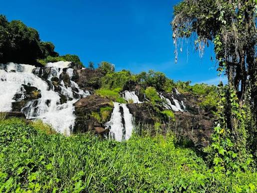
Northern Uganda climate follows broader East African patterns — two rainy seasons and two relatively drier windows — yet local conditions on the Gulu–Kitgum corridor can differ from what Kampala or Murchison Falls experience the same week. For Aruu Falls, weather matters because the visit is outdoors on exposed rock shelves, not inside a lodge or game-drive vehicle. Rain increases cascade drama but raises slip risk; dry spells simplify walking yet may lower flow across the multi-level layout.
Temperature and daily rhythm
Days in Pader District are often warm to hot on open rock, especially around midday when northern Uganda sun feels intense on unshaded shelves. Mornings and late afternoons are usually more comfortable for guided walks and photography. Nights cool modestly compared with highland parks — travelers basing in Gulu should still pack a light layer for evening meals and air-conditioned rooms.
Unlike montane forests at Bwindi or Sipi Falls, Aruu offers limited canopy shade on the main rock areas. Sun protection, hats, and hydration matter year-round.
Rainy seasons and waterfall flow
Uganda's long rains typically peak March through May; shorter rains often appear October through November, though year-to-year variation is normal. At Aruu, wetter months usually increase water volume — greener vegetation, fuller channels across rock shelves, and atmospheric photography — but wet stone becomes hazardous and approach roads slower. A 4×4 helps in rainy weeks on rough final legs.
After heavy rain, guides may restrict access to certain shelves or swimming pools because currents and submerged rocks change quickly. Never treat dry-season photos as current safety guidance.
Drier windows and access comfort
Broadly drier periods — roughly June through September and December through February — often simplify road access from Gulu and walking on rock. Flow may be lower, but many travelers find the site safer and easier to explore, especially families or guests with tight Kidepo transfer schedules. Peak international travel in these windows means confirming guides and vehicles if dates are fixed.
Dry-season dust on approach roads can still slow convoys — combine climate thinking with realistic drive-time buffers on the Gulu–Kitgum highway.
Regional comparison: Gulu, Kidepo, and West Nile
Gulu town forecasts generally approximate Aruu conditions, but always check the corridor you will drive that day. Kidepo farther northeast can run hotter and drier in some months. West Nile and Pakwach routing introduces Albert Nile humidity logic on different legs — relevant only when your wider northern loop includes those segments after Acholi waterfall time.
What to pack for Aruu weather
Carry quick-dry clothing, a light rain jacket even in “dry” months, grip shoes for wet rock, sun protection, and a dry bag for cameras near spray zones. Umbrellas help in sudden showers while walking; large ponchos can snag on rock edges — balance coverage with mobility.
If your itinerary continues to Kidepo or Murchison, pack one consistent daypack system so climate gear does not scatter across vehicle compartments during fast turnarounds in Gulu.
Climate change and year-to-year variation
Travelers increasingly report shifted rainfall timing across East Africa — a week forecast as dry may still deliver afternoon storms. Flexible scheduling and guide communication beat rigid hour-by-hour plans at waterfall sites. Ask your operator to reconfirm Aruu access the morning you travel if regional storms flooded approach roads overnight.
Month-by-month visit timing sits on our best time to visit page; safety implications on safety and travel health; access on how to get there.