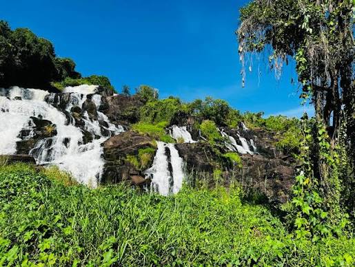
Map of Aruu Falls
Geography matters on northern Uganda safaris because straight-line distances mislead — road quality, bridge logic, and daylight hours shape real itineraries more than map pins. Aruu Falls sits in Angagura sub-county, Pader District, Acholi region, near the Gulu–Kitgum highway around Lupaya village. Commonly cited distances place the site about 47 km from Gulu and 57 km from Kitgum, though exact timing depends on turn-off conditions, approach roads, and stops.
Regional position in northern Uganda
On a country-scale map, Aruu occupies the transition zone between Gulu — northern Uganda's largest Acholi city — and the northeastern savannah corridor leading toward Kidepo Valley National Park. To the southwest, routes through Karuma Falls connect toward Murchison Falls National Park on the Nile. To the northwest, longer legs eventually reach Pakwach and West Nile towns such as Arua on Albert Nile routing — a different module from the Gulu–Kitgum axis but relevant when building wide northern loops from the same Gulu supply base.
Aruu is not inside a national park boundary. There is no gate coordinate comparable to Kidepo or Murchison — instead, travelers navigate highway logic, local turn-offs, and community guide meeting points. Confirm the current approach with a Gulu lodge or operator before departure because maintenance projects can shift access details.
Highway corridor and drive-time reality
The Gulu–Kitgum road is the backbone for most Aruu visits. From Gulu, allow roughly one to one-and-a-half hours each way under normal conditions, plus one to two hours on site with a guide. From Kitgum or when returning from Kidepo, the waterfall works as a scenic break if scheduled in morning or afternoon light — not as a rushed detour that consumes dusk driving on unfamiliar roads.
From Kampala or Entebbe, map distance to Aruu is misleading — you must reach Gulu first, typically five to seven hours depending on route and traffic. Treat Aruu as part of a northern circuit, not a capital day trip.
How Aruu relates to Kidepo and Murchison on the map
Kidepo lies far northeast — overland from Gulu/Kitgum often demands a long full-day drive or a two-day split. Aruu sits much closer to Gulu and should not be confused with a Kidepo access point. On the map, think of Aruu as a mid-corridor waterfall whereas Kidepo is the remote savannah destination at the end of the line.
Murchison Falls sits west of Gulu beyond Karuma bridge — a Nile park experience contrasting with Aruu's rock-shelf cascades. Many travelers never backtrack optimally if they place Aruu on the wrong leg; sequencing Gulu → Aruu → Kitgum → Kidepo differs from Murchison → Karuma → Gulu → Aruu → northbound.
Local landmarks and orientation tips
Guides and drivers often reference Lupaya village, Angagura sub-county, and Pader District administration names rather than GPS alone. Mobile coverage can be patchy on approach roads — download offline maps for the Gulu–Kitgum corridor and share planned return times with your lodge. The embedded map on this page uses place-name geocoding; verify final turns with on-ground guidance.
Distances on safari routes are often longer than they look on a screen. We quote realistic drive times — not straight-line estimates — when placing Aruu between Gulu, Kitgum, and Kidepo.
Using this map in itinerary planning
Before you travel, mark three anchors: your overnight town (usually Gulu or Kitgum), your fixed commitments (Kidepo lodge check-in, Murchison boat safari), and your daylight buffer. Slot Aruu only where it reduces fatigue rather than adding a midnight highway leg. Pair map study with our how to get there, nearby destinations, and best time to visit pages for complete northern Uganda planning.