Tour overview
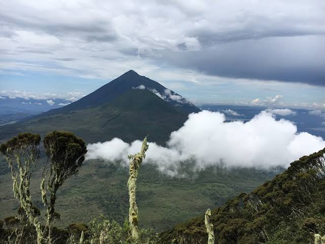
Mount Muhabura (4,127 m) — “The Guide” in local Rufumbira — is the tallest of Mgahinga’s three volcanoes and the most demanding day hike in the park. The summit holds a small crater lake and, on clear days, views across five other Virunga peaks, Lake Bunyonyi and even the Rwenzori range. Fitness and altitude acclimatisation matter; the round trip takes 8–10 hours.
Places you visit
Key stops along this itinerary — customise dates and lodges when you enquire.
- Entebbe (Start, End)
Day-by-day itinerary
Kampala/Kigali to Kisoro & Mgahinga foothills
Your private 4×4 safari vehicle and English-speaking driver-guide collect you from Kampala or Entebbe before dawn for the long southwest run via Masaka, Mbarara and Kabale (approx. 8–9 hours on tarmac). From Kigali the route is shorter — approx. 4–5 hours through the Cyanika border post into Kisoro district, with Virunga volcano views opening across the valley as you clear immigration. Pause at the Uganda Equator at Kayabwe on the Kampala route for coffee and the water-drain demonstration, then continue through Ankole cattle country as the Albertine Rift escarpment rises on the western horizon.
The final approach to Kisoro climbs through terraced hills and eucalyptus groves — on clear afternoons the three volcanic cones of Muhavura, Gahinga and Sabinyo dominate the skyline above the town. Kisoro sits at roughly 1,890 m elevation at the foot of the Virunga chain, which stretches south into Rwanda’s Volcanoes National Park and the Democratic Republic of Congo’s Virunga National Park. You are entering Uganda’s smallest national park — Mgahinga Gorilla National Park protects just 33.7 km² of montane forest and volcanic slopes, yet packs mountain gorillas, golden monkeys and three climbable peaks into a compact high-altitude reserve.
Check in near Ntebeko park headquarters or in Kisoro town itself. Mount Muhabura (4,127 m) — “The Guide” in local Rufumbira — is the tallest of Mgahinga’s three volcanoes and the most demanding day hike in the park. Your guide briefs you on tomorrow’s climb: permit check-in at Ntebeko, porter hire, packing list and realistic fitness expectations. The round trip takes 8–10 hours and the summit holds a small crater lake often mist-shrouded until mid-morning. Start training with hill walks before you arrive — Muhabura punishes unprepared legs on the steep upper scree.
Porter hire is strongly recommended; local porters know the trail, carry your daypack on the relentless upper sections and earn fair wages through the community association at Ntebeko. Sleeping at 1,890 m tonight helps acclimatisation before tomorrow’s push above 4,000 m — avoid alcohol, hydrate well and aim for an early night. Dinner with views toward the Muhabura cone; the summit ridge is visible from many lodge terraces when clouds lift at sunset.
Drive time: Approx. 8–9 hours from Kampala or Entebbe; 4–5 hours from Kigali via Cyanika
Meals: Lunch & dinner
Accommodation: Kisoro or Ntebeko lodge
Mount Muhabura volcano hike — summit and crater lake
Pre-dawn tea at the lodge, then transfer to Mgahinga Ntebeko headquarters for registration, safety briefing and allocation of UWA ranger escorts. Muhabura hiking permits are date-specific and limited — your booking locks the morning start slot that makes this day the centrepiece of the itinerary. The trailhead sits above the bamboo zone; by first light you are already climbing through dense Arundinaria alpina bamboo where golden monkeys and duiker sometimes cross the path before the forest opens into montane woodland.
The lower slopes pass through Hagenia-Hypericum forest and giant lobelia stands — altitude gain is steady and unrelenting, with few flat sections to recover. Your ranger sets a sustainable pace; turning back is always an option if altitude symptoms appear, though fit groups typically reach the crater rim between late morning and early afternoon. The middle zone transitions into Afro-alpine moorland — giant lobelia, senecio and tussock grass on exposed ridges where the wind picks up sharply above 3,500 m.
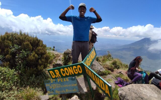
The final push crosses loose volcanic scree and bare rock to Muhabura summit at 4,127 m — the highest point in Mgahinga and the tallest of the park’s three Virunga cones (Gahinga at 3,474 m and Sabinyo at 3,669 m are gentler or more technical alternatives). The summit crater holds a small, often mist-shrouded lake — a surreal reward after 4–5 hours of ascent. On exceptional clear mornings in the dry seasons (June–August and December–February), views extend across five other Virunga peaks, the terraced islands of Lake Bunyonyi to the east and, with luck, the snow-capped Rwenzori Mountains far to the north — a 360-degree panorama from Uganda’s most demanding day hike.
The upper slopes are fully exposed; weather can change from sunshine to cold rain within an hour, so waterproof jacket, gloves, warm hat and thermal layers are essential even on equatorial latitude. Pack 2–3 litres of water, high-energy snacks and a packed lunch — there is no water source above the bamboo belt. Trekking poles help enormously on the descent through scree that shifts underfoot; many climbers describe the downhill as harder on knees than the ascent. UWA rangers carry first-aid kits and maintain radio contact with Ntebeko headquarters throughout the day.
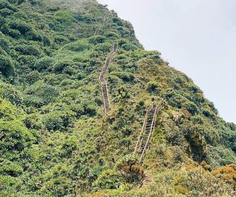
Long descent by late afternoon — expect to reach the trailhead between 16:00 and 18:00 depending on fitness and summit time. Return to the lodge for hot shower, dinner and well-earned rest. This is not a trek to underestimate: Muhabura is a genuine mountaineering day by Ugandan standards, steeper and higher than Gahinga and without Sabinyo’s ladders but with more altitude and exposure. Clear mornings in the dry season give the best summit views; cloud often rolls in by midday even when dawn starts fine.
Trek duration: 8–10 hours round trip (4–5 hours ascent, 3–4 hours descent)
Meals: Breakfast, packed lunch & dinner
Accommodation: Kisoro or Ntebeko lodge

Activity | Mount Muhabura volcano hike
Full-day climb to 4,127 m with crater lake at the summit — 8–10 hours round trip through bamboo, montane forest and exposed Afro-alpine ridges, the toughest and highest of Mgahinga’s three Virunga peaks.Recovery, optional golden monkeys — return to Kampala or Kigali
Relaxed breakfast at the lodge — your legs will feel yesterday’s descent, so avoid scheduling an early departure unless necessary. Optional morning golden monkey tracking in Mgahinga (separate permit through UWA) suits travellers with energy left after Muhabura: endemic Cercopithecus kandti troops feed in bamboo thickets near Ntebeko and the encounter is typically shorter and less strenuous than the volcano day. Alternatively, a gentle walk through surrounding farmland or a coffee on Kisoro Main Street with the Virunga cones as backdrop.
Check out and begin the return drive to Kampala, Entebbe or Kigali. Routing via Kabale allows an optional lunch stop at Lake Bunyonyi — 29 islands, dugout canoes and terraced hills at roughly 1,962 m elevation make a scenic recovery break after yesterday’s summit push. The lake is bilharzia-free and historically malaria-free at this altitude; fresh tilapia at lakeside lodges is a standard stop. From Bunyonyi the road continues north through Kabale town and Mbarara to Kampala (approx. 8–9 hours total from Kisoro), or south through Cyanika to Kigali (approx. 4–5 hours).
Celebrate the climb — Muhabura is the highest point most hikers reach in southwestern Uganda without expedition gear, and the crater lake at the top rewards the effort on clear mornings. The descent is hard on knees; allow a full recovery morning before long drives if your international flight permits. Entebbe airport drop-off can be arranged for late-evening flights from the Kampala route; Kigali departures suit Rwanda-based travellers who entered via Cyanika on Day 1.
Mgahinga’s three volcanoes offer a clear progression: Gahinga is the gentlest introduction, Sabinyo adds ladders and tri-border drama, and Muhabura is the altitude test. This 3-day route dedicates Day 2 entirely to the summit — transfer, climb, recover — without splitting attention across gorilla permits or golden monkeys unless you add them on departure morning.
Drive time: Approx. 8–9 hours to Kampala or Entebbe; 4–5 hours to Kigali
Meals: Breakfast & lunch
What's included
- Muhabura hiking permit
- Ranger escort
- 2 nights, 4×4, meals
What's not included
- Porters
- Visa, insurance, tips
Accommodation & comfort level
Mount Gahinga Lodge or Kisoro Travelers Rest.
Request Pricing & booking information
Request Quote: Fill in the contact form below.