3 Days Mgahinga Volcanoes Hiking Safari
Uganda · Gorilla park highlands
Tour overview
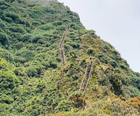
Mount Gahinga (3,474 m) is the gentlest of Mgahinga’s three Virunga volcanoes — a 6–7 hour round trip through bamboo forest to a swamp-filled crater at the summit. This 3 Days Mgahinga Volcanoes Hiking Safari suits travellers who want Albertine Rift scenery, crater-lake views and optional golden monkey or gorilla add-ons without the wooden ladders of Sabinyo or the altitude of Muhabura.
From Kampala or Entebbe you drive roughly 8–9 hours southwest via Mbarara and Kabale; from Kigali via Cyanika border it is 4–5 hours. Mgahinga is Uganda’s smallest national park — just 33.7 km² — but it packs three dormant volcanoes, mountain gorillas, golden monkeys and Batwa heritage into one compact Virunga corner shared with Rwanda and DR Congo.
Places you visit
Key stops along this itinerary — customise dates and lodges when you enquire.
- Entebbe (Start, End)
Day-by-day itinerary
Kampala, Entebbe or Kigali to Kisoro & Mgahinga foothills
Your private 4×4 safari vehicle and English-speaking driver-guide collect you from Kampala, Entebbe or Kigali for the southwest run into Kisoro district — the gateway to Uganda’s Virunga volcanoes. From Kampala or Entebbe the route follows the Masaka–Mbarara highway through Ankole cattle country, then climbs the Kigezi highlands past Kabale’s terraced hillsides (approx. 8–9 hours on tarmac). From Kigali via the Cyanika border crossing it is approx. 4–5 hours — a popular routing for travellers combining Rwanda and southwest Uganda without backtracking through Kampala.
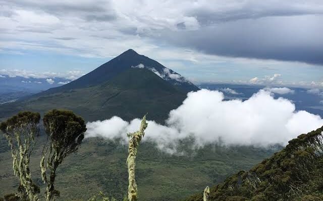
Pause for lunch in Mbarara or Kabale — grilled goat, matoke and fresh pineapple from roadside stalls — before the final descent into Kisoro basin, where three volcanic cones dominate the skyline: Mount Muhabura (4,127 m), Mount Gahinga (3,474 m) and Mount Sabinyo (3,669 m). On clear afternoons the snow-capped peaks of the Rwenzori range appear north-west beyond Lake Mutanda, and the twin lakes of Mutanda and Mulehe glitter in the valley below. Kisoro town sits at roughly 1,800 metres — cool enough for a fleece at dinner even on the equator.
Arrive at Mgahinga Gorilla National Park headquarters at Ntebeko for a short orientation. Mgahinga protects montane forest, bamboo zones and volcanic slopes on the Uganda sector of the Virunga Massif — part of the same chain as Rwanda’s Volcanoes National Park and DR Congo’s Virunga National Park. The park holds one habituated mountain gorilla family (Nyakagezi, which occasionally crosses into Rwanda), endemic golden monkeys, buffalo on the lower slopes and more than 180 bird species including Rwenzori turaco and handsome francolin.
Check in at your lodge near Ntebeko or in Kisoro town. Mount Gahinga Lodge sits on the park boundary with views straight up the Gahinga cone; Kisoro Travelers Rest Hotel — a historic Hemingway-era stop — offers mid-range comfort in town; Amajambere Iwacu Community Camp is the budget option closest to the trailhead. Your guide briefs you on tomorrow’s hike: trail conditions, packing list, porter hire (recommended, typically USD 15–20 paid locally) and weather windows. Gahinga is the gentlest of the three peaks — a good warm-up if you plan Sabinyo’s ladders or Muhabura’s altitude on a future trip.
Optional add-ons for a longer stay: gorilla trekking in Mgahinga (permits occasionally available with shorter notice than Bwindi) or golden monkey tracking on departure morning. Dinner with views toward the volcanic cones. Early night — trek day starts at dawn.
Drive time: Approx. 8–9 hours from Kampala or Entebbe; approx. 4–5 hours from Kigali via Cyanika
Meals: Lunch & dinner
Accommodation: Kisoro or Ntebeko lodge
Mount Gahinga volcano hike — crater swamp summit
Pre-dawn tea at the lodge, then transfer to Ntebeko park headquarters for the mandatory UWA ranger briefing. Hiking permits are issued here alongside gorilla and golden monkey permits — your guide handles registration and conservation fees. Rangers explain trail etiquette, weather risks and the volcanic geology of the Virunga chain: Gahinga, Sabinyo and Muhabura are dormant stratovolcanoes formed along the East African Rift, their slopes clothed in bamboo, Hagenia woodland and Afro-alpine moorland above 3,000 metres.
With UWA rangers and optional porters, you begin the ascent through dense bamboo forest — the same habitat that holds Mgahinga’s golden monkeys and occasional buffalo on the lower slopes. The trail is well maintained but steepens steadily; trekking poles help on muddy sections after rain. Duiker, bushbuck and varied sunbirds are common in the understorey; guides listen for golden monkey calls in the canopy though today’s focus is the summit push. The bamboo zone gives way to montane forest and then open moorland studded with giant lobelia and senecio as you approach the crater rim.
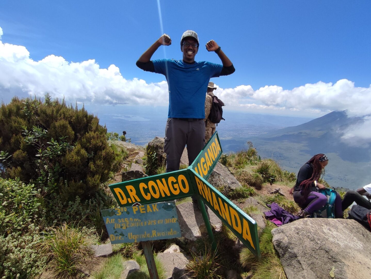
The Gahinga crater swamp summit is otherworldly — a shallow, moss-filled bowl where lobelia, sedges and giant groundsels ring a misty crater lake. On clear mornings views extend across the Virunga chain toward Sabinyo’s serrated ridge and Muhabura’s broad cone; Lake Bunyonyi and the Kigezi highlands spread north below the cloud line. Less technical than Sabinyo’s ladder sections, less altitude than Muhabura’s 4,127 m summit — Gahinga rewards fit hikers with genuine mountaineering atmosphere without the rope assists required on the tri-border peak.
Descent follows the same trail, typically reaching Ntebeko by mid-afternoon. Return to the lodge for rest, hot shower and optional massage at Mount Gahinga Lodge. A short walk through surrounding potato and pyrethrum farmland offers a gentler stretch for tired legs — the Kisoro valley is one of Uganda’s highest-altitude farming belts, and the volcanic soils produce exceptional Irish potatoes and beans sold at Kisoro market. Dinner and overnight. Tomorrow holds optional golden monkey tracking or a Batwa cultural experience before the return drive.
What to pack for trek day: Waterproof hiking boots; gaiters; warm layers and rain jacket; hat and gloves for the summit; 2–3 litres of water; packed lunch (provided); energy snacks; daypack under 8 kg; camera in a dry bag. The upper slopes are exposed and weather changes quickly — dry months (June–August, December–February) give the firmest trails and clearest views, though Mgahinga receives rain in every season.
Trek duration: Approx. 6–7 hours round trip
Meals: Breakfast, packed lunch & dinner
Accommodation: Same lodge as Day 1
Activity | Mgahinga volcanoes hike
Full-day trek to the Gahinga crater swamp summit at 3,474 m — 6–7 hours round trip through bamboo forest and Afro-alpine moorland, the gentlest of Mgahinga’s three Virunga peaks and an ideal introduction to volcano hiking in Uganda.Golden monkey trek or Batwa cultural walk — departure
Leisurely breakfast at the lodge, then your choice of a light morning activity before the return drive north or east. Golden monkey tracking (separate UWA permit, typically USD 60 foreign non-resident — confirm when booking) takes you into the same bamboo thickets you crossed yesterday — endemic to the Virungas, these copper-backed primates move in fast, noisy troops and are habituated for tourism near Ntebeko. The trek usually runs 2–3 hours and suits travellers who want a primate encounter without the physical demand of a second volcano day.
Alternatively, a Batwa cultural walk with indigenous forest guides shares the story of the “Keepers of the Forest” — the Batwa were the original inhabitants of these montane woods before park gazettement in 1991, and community-led experiences near Mgahinga cover traditional hunting demonstrations, herbal medicine, fire-making and song in the shadow of the volcanoes. Both add-ons finish by late morning, leaving time for the long drive back to Kampala, Entebbe or Kigali.
Check out and begin the return journey. Routing via Kabale allows an optional lunch stop at Lake Bunyonyi — 29 islands, dugout canoes and terraced hillsides make a scenic break after two days in the Virunga foothills. The Kampala run (approx. 8–9 hours) retraces the Mbarara highway; the Kigali run (approx. 4–5 hours) crosses Cyanika with views back toward the three cones. Scheduled flights from Kisoro airstrip to Entebbe can be arranged if you are linking onward by air — ask when booking.
Mgahinga is Uganda’s smallest national park, but this 3-day loop proves you do not need a week to hike a Virunga volcano, sleep in mountain air and still add primates or culture on departure morning. Gahinga is the gentlest introduction to the chain — save Sabinyo’s tri-border ladders and Muhabura’s crater lake for your return visit. Entebbe airport drop-off can be arranged for late-evening flights from the Kampala route; Kigali departures suit Rwanda-based travellers who entered via Cyanika on Day 1.
Drive time: Approx. 8–9 hours to Kampala or Entebbe; approx. 4–5 hours to Kigali
Activity duration: Optional 2–3 hours golden monkey or Batwa walk
Meals: Breakfast & lunch
Activity | Golden monkey tracking (optional)
Morning primate trek in Mgahinga’s bamboo forest — endemic golden monkeys are a Virunga specialty and a lighter add-on after yesterday’s Gahinga summit push.What's included
- Mount Gahinga hiking permit and UWA ranger escort
- Private 4×4 safari vehicle and English-speaking guide
- Mgahinga Gorilla National Park entrance fees
- 2 nights Kisoro or Ntebeko lodge accommodation
- Meals as indicated
- Bottled drinking water in the vehicle
What's not included
- Porter hire on trek day (approx. USD 15–20, paid locally)
- Golden monkey or gorilla trekking permits (optional add-ons)
- Batwa cultural walk fee (optional)
- International flights, Uganda visa and travel insurance
- Alcoholic drinks, tips and personal expenses
Accommodation & comfort level
Luxury: Mount Gahinga Lodge. Mid-range: Kisoro Travelers Rest Hotel or Lake Mulehe Safari Lodge. Budget: Amajambere Iwacu Community Camp near Ntebeko.
Request Pricing & booking information
Request Quote: Fill in the contact form below.