Map of Arua and West Nile routing
On a Uganda map, Arua occupies the northwestern corner — distant from the Kampala–Entebbe airport cluster and the classic southwest gorilla highway, yet strategically placed for travelers building West Nile Uganda itineraries. Understanding Arua's position clarifies why the city functions as a logistics base rather than an in-park destination.
Arua within West Nile and border geography
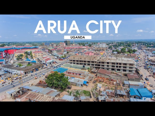
Arua is the principal urban centre of West Nile, a region shaped by the Albert Nile, Lake Albert Region rift landscapes, and trade corridors toward South Sudan and the Democratic Republic of Congo. Regional city status since 2020 reflects administrative importance matching its transport role. Culturally, West Nile includes Lugbara, Madi, Alur, Kakwa, Aringa, and other communities whose settlement patterns explain why routes radiate in multiple directions from Arua rather than along a single tourist spine.
Key routes west and south: Nebbi, Pakwach, Murchison
The most common safari map logic runs south and west from Arua toward Nebbi and Pakwach along Albert Nile corridors, then onward to Murchison Falls National Park for classic wildlife. In reverse planning — Murchison first, West Nile second — travelers trace the same line after boat safari and game drives, converting wildlife memories into market culture and Ajai conservation depth.
Drive times vary by season and stops; treat Pakwach–Nebbi–Arua segments as full travel days in itinerary maps, not quick map-distance guesses.
Ajai Wildlife Reserve on the map
Ajai Wildlife Reserve lies east to southeast of Arua in Madi-Okollo — the primary conservation neighbour most travelers mean when they ask about wildlife near the city. Map planning should show Ajai as a separate rural leg requiring dawn departure from Arua hotels, not a district inside city limits. Papyrus swamp, wooded savannah, and Albert Nile-influenced lowlands define Ajai's position relative to urban Arua.
Albert Nile and Lake Albert context
West Nile ecology ties to the Albert Nile and Lake Albert rift west of Arua's main orbit. Map readers should visualize river-connected wetlands, fishing communities, and seasonal agriculture between Arua, Nebbi, and Pakwach — habitat continuity that matters for birding routes and photography stops even when you are not entering a named park gate.
Northern and eastern arcs: Gulu and Kidepo
Longer northern Uganda maps extend from West Nile toward Gulu and, for committed travelers, Kidepo Valley National Park in the northeastern corner. Kidepo is not adjacent to Arua — it requires multi-day overland planning, dry-season margin, and operator familiarity with northeastern roads. Map Arua as a West Nile anchor on the way to or from these remote savannah destinations, not as a same-day Kidepo suburb.
Arrival from Kampala and Entebbe
Most international visitors enter via Entebbe and reach Arua by road through northern Uganda — commonly via Murchison and Pakwach or via Gulu depending on the arc. Map distances understate fatigue; break the journey visually on your itinerary with overnight stops. Regional flights may operate to Arua's airfield at times — verify schedules before map-planning around air access.
Using the map for daily pacing
Plot city activities — markets, crafts, restaurants — within Arua's urban core on day one. Plot Ajai, Mount Wati approaches, or Albert Nile margin stops as separate rural days with early starts. Mixing both on one map without time buffers produces rushed trips that miss West Nile's cultural reward.
Detail pages: getting to Arua, things to do in Arua, destinations near Arua, and best time to visit Arua.