When travellers ask how large Volcanoes National Park is, they are usually weighing two things: whether the park can fill a multi-day itinerary, and how its size compares to neighbouring gorilla destinations such as Bwindi Impenetrable National Park in Uganda or the much larger Virunga National Park in the Democratic Republic of Congo. The short answer is that Volcanoes is modest by African standards — about 160 square kilometres — but its ecological importance far exceeds its footprint.
That compactness is part of what makes Rwanda's flagship park so efficient for gorilla trekking. Most lodges cluster in Musanze (Ruhengeri), and trailheads for habituated gorilla families lie within a short drive. You are not crossing a Texas-sized wilderness to reach your trek. You are entering a high-altitude rainforest belt pressed against volcanic slopes, where every hectare matters because it forms part of a transboundary ecosystem shared with two other countries.
The numbers: area, elevation, and boundaries
Volcanoes National Park spans 160 km² (62 square miles), equivalent to roughly 16,000 hectares. It sits between about 2,400 and 4,507 metres above sea level, with Mount Karisimbi marking the highest point inside the park. The terrain is steep, volcanic, and heavily forested — bamboo zone at lower elevations giving way to Hagenia-Hypericum woodland and Afro-alpine moorland higher up.
The park forms the Rwandan portion of the Virunga Massif, a chain of eight volcanoes straddling Rwanda, Uganda, and the DRC. Within Volcanoes itself, five volcanoes are protected: Karisimbi, Bisoke, Muhabura, Gahinga, and Sabyinyo. To the south and west, the park borders Virunga National Park in the DRC — at roughly 7,800 km², one of Africa's largest protected areas. To the north, it meets Mgahinga Gorilla National Park in Uganda, which covers just 34 km² but completes the tri-national gorilla habitat corridor.
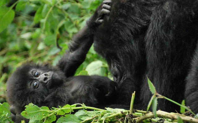
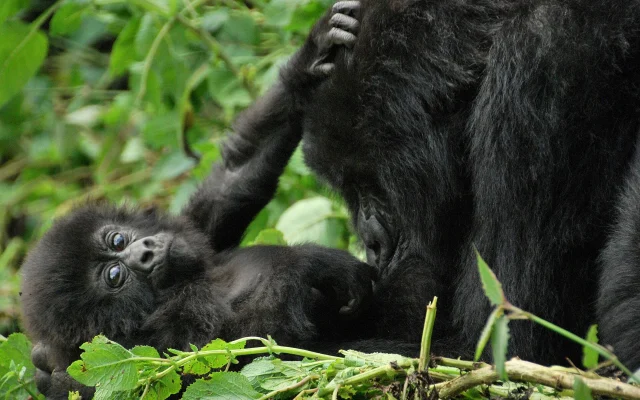
Understanding this geography matters. Mountain gorillas do not recognise national borders. They move through contiguous forest across Rwanda, Uganda, and the DRC. Volcanoes may be small, but it is a critical slice of a much larger transboundary landscape that holds one of only two remaining wild populations of the endangered mountain gorilla.
Why the park feels larger than 160 square kilometres
On paper, 160 km² is smaller than many city municipalities. In practice, the park feels substantial because:
- Altitude changes are dramatic — trails climb through multiple vegetation zones in a single day
- Forest density is high — Afro-montane rainforest is structurally complex and slow to traverse
- Activities are spread across sectors — gorilla trekking, golden monkey tracking, volcano hikes, and cultural visits each use different entry points
- Adjacent communities are dense — four districts (Burera, Musanze, Nyabihu, and Rubavu) press against the park boundary, with population densities among Rwanda's highest at 500 to 1,041 people per km²
Research published in 2023–2025 notes that agriculture dominates land use in parishes bordering the park. That human pressure explains why park size is not merely a trivia question — it is a conservation planning variable. When farms press against forest edges, gorillas crop-raid, people lose harvests, and the political case for protection weakens unless buffer strategies are designed carefully.
The expansion programme: from 13,000 to 23,000 hectares
In 2022, the Government of Rwanda announced a major Volcanoes National Park Expansion Programme — a multi-year, roughly US $225–255 million initiative designed to increase the park from about 13,000 hectares to 23,000 hectares (an increase of roughly 77%).
The expansion is structured in two parts:
- 3,740 hectares added directly to core park habitat for gorillas and other wildlife
- 6,260 hectares designated as a buffer zone for community agroforestry — tree crops and mixed farming that create a transition zone between villages and forest
The Rwanda Development Board and partners, including the Paris Peace Forum-backed programme, project that the expansion could increase the mountain gorilla population by 15–20%, reduce infant gorilla mortality by up to 50%, and cut human–wildlife conflict by as much as 80%. Tourism revenue targets include a doubling of direct park income and a 15–20% increase in gorilla viewing capacity — significant in a park where foreign non-resident gorilla permits are currently US $1,500 per person.
A pilot phase of the expansion was scheduled to begin in 2024. For travellers planning Rwanda itineraries in coming years, the programme may gradually shift trekking sectors, lodge locations, and community experiences as new buffer landscapes mature.
How Volcanoes compares to other gorilla parks
Size alone does not determine trek quality, but comparisons help with itinerary design:
- Bwindi Impenetrable National Park (Uganda) — approximately 321 km², with gorilla groups spread across four sectors (Buhoma, Ruhija, Rushaga, Nkuringo). Treks can be longer and more dispersed.
- Mgahinga Gorilla National Park (Uganda) — 34 km², sharing the same Virunga volcanoes as Volcanoes but with fewer habituated groups.
- Virunga National Park (DRC) — vast at 7,800+ km², but security and logistics are more complex for most international visitors.
- Volcanoes National Park (Rwanda) — 160 km², with a high-value, low-volume tourism model and excellent road access from Kigali.
Many travellers combine Uganda and Rwanda gorilla trekking precisely because the Virunga ecosystem spans both countries. A trek in Volcanoes and a trek in Bwindi or Mgahinga visits different administrative parks within the same biological region.
What the park's size means for wildlife and habitats
Despite its modest area, Volcanoes shelters remarkable biodiversity. Habitats include bamboo forest (critical for golden monkeys), montane rainforest, swamps, and high-altitude meadows. Large mammals include forest elephants, buffalo, spotted hyena, and black-fronted duiker. The park holds roughly 200 bird species, including 13 Albertine Rift endemics such as the Rwenzori turaco and handsome francolin.
The park's size has historically made it vulnerable. In the 1960s–1970s, portions were cleared for pyrethrum cultivation and human settlement under colonial administration. Dian Fossey's Karisoke Research Centre, established in 1967 between Karisimbi and Bisoke, helped reverse the trajectory of mountain gorilla decline through anti-poaching patrols and scientific monitoring — work that continues today under the Rwanda Development Board and conservation partners.
Because the park is small and surrounded by people, every hectare of intact forest has outsized value. Losing even a narrow corridor can isolate gorilla groups, increase inbreeding risk, and intensify crop raiding. That is the ecological logic behind the expansion and buffer-zone strategy.
Planning your visit around park geography
For most visitors, two to three nights near Musanze is enough to cover gorilla trekking, an optional golden monkey trek, and a volcano day hike such as Mount Bisoke's crater lake. The park's compact size rewards early starts — briefing centres are close to lodges, and rangers can assign groups to nearer trailheads when fitness or weather demands it.
Volcano hikes range from moderate (Bisoke, typically five to six hours round trip) to strenuous multi-day expeditions (Karisimbi, two days with camping). These hikes use the same volcanic slopes that gorillas inhabit, offering a different perspective on the park's vertical geography.
If you are building a combined Rwanda–Uganda circuit, allow road transfer time between Volcanoes and Bwindi (roughly four to six hours via Cyanika or Katuna border crossings, depending on routing). The parks are geographically adjacent but administratively separate — permits must be booked in each country.
Conservation context: small park, global stakes
Volcanoes National Park protects roughly one third of the world's remaining mountain gorillas — a species numbering just over 1,000 individuals across the Virunga Massif and Bwindi-Sarambwe ecosystem. The park's 160 km² is therefore not a local concern; it is a global conservation priority.
Tourism funds the protection that makes this small park viable. Permit revenue supports ranger patrols, veterinary care, community revenue sharing (10% of tourism income to neighbouring communities), and the expansion programme that will add habitat and buffer farmland. When you pay for a gorilla permit at Volcanoes, you are paying to keep a disproportionately important slice of forest intact in one of the most crowded rural landscapes in East Africa.
Volcanoes National Park is not large in the way Serengeti or Queen Elizabeth are large. It is concentrated — a dense, volcanic, rainforest refuge where size is measured not in endless plains but in the survival of a species the world nearly lost.
Quick reference for itinerary planning
- Total area: 160 km² (16,000 hectares), expanding toward 23,000 hectares
- Elevation range: roughly 2,400–4,507 metres
- Volcanoes inside the park: five of eight Virunga Massif peaks
- International borders: contiguous with Virunga NP (DRC) and Mgahinga (Uganda)
- Drive time from Kigali: approximately 2–3 hours to Musanze trailheads
- Recommended stay: two to three nights for gorilla trekking plus one additional activity