Vervet monkey habitat spans the woodland savannah, riverine galleries, and acacia margins that define Uganda's flagship game parks. Chlorocebus pygerythrus is not a deep-forest specialist like red-tailed monkeys or a montane bamboo dweller like golden monkeys — it thrives in edge habitat where trees offer refuge, open ground supplies grasses and fallen fruit, and water lies within daily reach. Understanding where vervets live explains their abundance along the Kazinga Channel, Murchison's Nile corridors, and Lake Mburo's acacia hills. Connect this page to vervet facts, behaviour, and where to see vervet monkeys.
Woodland–Savannah Edge Specialists
Across East Africa, vervet monkeys are the default primate of acacia savannah — abundant, visible, and closely tied to the structural complexity of woodland margins. They avoid closed rainforest interiors but penetrate forest fringes wherever figs, acacia pods, and insect-rich understorey exist. In Uganda, that preference places them squarely in the ecosystems travellers already visit for Big Five game drives: Queen Elizabeth National Park, Murchison Falls National Park, and Lake Mburo National Park.
Research on Chlorocebus species shows selection for habitat offering simultaneous food, sleeping sites, and escape routes. Vervets sleep in trees — typically tall acacia, fig, or mahogany — and descend at dawn to forage on the ground. The daily commute between canopy refuge and terrestrial feeding grounds shapes their distribution across every park sector with suitable tree cover.
Water Dependence and Daily Ranging
Vervets drink regularly when surface water is available, visiting rivers, lakes, and permanent springs throughout the day. During wet seasons they may derive moisture from lush vegetation, but dry months concentrate troops along the Kazinga Channel, Murchison's Victoria Nile, and Lake Mburo shorelines — precisely where boat safaris and game-drive tracks intersect.
Home ranges vary with troop size and food abundance. Studies in East Africa report ranges from roughly 0.1 to 0.5 square kilometres for smaller troops up to several square kilometres for large groups in resource-poor seasons. In Uganda's productive savannah parks, vervets often maintain compact territories centred on fig groves, lodge perimeters, and riverine galleries.
Vegetation Types Vervets Use
Typical vervet habitat in Uganda includes:
- Acacia–grassland mosaics with scattered umbrella and whistling thorn trees
- Riverine gallery forest along the Nile, Kazinga Channel, and Kyambura approaches
- Fig-dominated woodland margins where fruit supports large troops
- Lodge and camp ecotones with ornamental fruiting trees and lawn grasses
- Rocky kopje edges with mixed bush and open grazing
- Regenerating savannah after fire or light browsing pressure
They generally avoid extreme open plains without tree cover and closed montane forest above roughly 3,000 metres — which is why Bwindi's interior holds colobus and chimpanzees but not vervets, while park approach roads and community land at lower elevations often do.
Altitude and Climate in Uganda
Queen Elizabeth spans roughly 900 to 1,400 metres across the Western Rift floor and escarpment. Murchison's north bank sits near 700 to 1,000 metres; Lake Mburo rises to about 1,500 metres on acacia hills. Tropical bimodal rainfall — peaks typically March to May and September to November — drives fruiting cycles and grass growth that vervets track through seasonal foraging shifts.
Temperature variation is modest compared with seasonal food availability. Dry months (June to September and December to February) simplify game-drive access and concentrate wildlife near water — including vervet troops drinking at channel margins and fig groves.
Queen Elizabeth National Park — Vervet Ecosystem
Queen Elizabeth supports some of Uganda's highest vervet densities thanks to the Kazinga Channel linkage between Lake George and Lake Edward, extensive acacia woodland on the Kasenyi Plains, and fig-rich margins in the Ishasha sector. Troops forage beside Uganda kob, buffalo, and warthog on standard game-drive circuits.
Key Habitat Zones
- Kasenyi Plains and track networks: Open grassland with scattered acacia — ground foraging beside antelope herds
- Kazinga Channel banks: Riverine gallery with daily drinking and fig fruiting
- Mweya peninsula: Lodge ecotones where semi-habituated troops exploit ornamental trees
- Ishasha woodland margins: Southern fig–acacia mosaic shared with tree-climbing lions
- Kyambura gorge approaches: Forest–savannah transition with mixed primate communities
Murchison Falls National Park — Nile Corridor Habitat
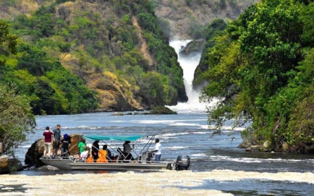
Murchison Falls offers vervet habitat along the Victoria Nile, in Rabongo Forest margins, and on north-bank Borassus palm grasslands where woodland fingers reach toward open plain. Nile launch cruises reveal troops on riverbanks; game drives on the Buligi circuit pass fig groves where juveniles play in canopy.
The park's scale — Uganda's largest protected area — means vervet distribution is patchy rather than uniform. Concentrate on riverine sectors, forest edges, and lodge grounds rather than vast open Borassus tracts where tree cover thins.
Lake Mburo National Park — Compact Acacia Mosaic
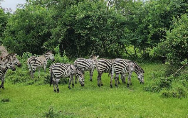
Lake Mburo packs acacia hills, lake shores, and woodland ridges into Uganda's smallest savannah national park. Vervets share tracks with impala, zebra, and eland — a primate–antelope combination unavailable in primate-only forest reserves. Walking safaris where permitted offer ground-level perspective on troop movement through acacia thickets.
Lodge Ecotones and Human Interface
A distinctive vervet habitat in Uganda is the tourist lodge perimeter — fruiting trees, lawn grasses, and unsecured waste that attract semi-habituated troops. Mweya, Paraa, and Mburo lodges routinely host vervets at dawn. This interface offers excellent photography but creates conservation challenges when animals learn to raid kitchens and vehicles. Responsible waste management and never feeding wild monkeys are essential lodge practices.
Predator–Habitat Overlap
Vervets select habitat with visibility for sentinel posting yet enough canopy for escape. Leopard exploit woodland edges; martial and crowned eagles hunt from above; python ambush at ground level. The overlap between vervet sleeping trees and predator hunting zones is constant — which is why vervet alarm calls are among the most reliable predator indicators on Uganda game drives.
Habitat Threats
Outside protected areas, woodland clearance for agriculture reduces sleeping and foraging sites. Inside parks, invasive plant species, boundary encroachment, and lodge food dependency alter natural ranging. Crop-raiding at park edges triggers retaliatory killing — a human–wildlife conflict pattern addressed on our conservation page.
Safari Viewing and Habitat Ethics
Stay on designated tracks, secure food in vehicles and rooms, and never feed vervets — habituation increases aggression and road mortality. Off-track driving damages the grass–woodland mosaic troops depend on. Tourism revenue supports Uganda Wildlife Authority habitat management and community programmes around park boundaries.
Planning Your Visit
For habitat-focused vervet viewing, prioritise dawn drives and channel boat cruises in the dry season at Queen Elizabeth and Murchison, combine with our best time to see vervet monkeys guide, and build savannah days into western circuits via Uganda safari packages linking gorilla trekking and chimpanzee forests.