Overview of Mount Kadam
Mount Kadam sits north of Mount Elgon and forms part of the volcanic highland chain that gives eastern and northeastern Uganda its dramatic edge. It is often described as Karamoja's second-highest mountain and is notable for its prominence, remote feel, and cultural complexity. Its slopes rise from dry plains into forest, thicket, rocky ridges, and cooler highland zones.
The mountain is not a mass-tourism hiking route. It should be treated as a guided expedition with local coordination, porter planning if needed, and flexibility around weather, trail conditions, and community access. That rawness is central to its appeal. A Mount Kadam trek can feel like a genuine journey through a living mountain landscape, not a packaged summit walk.
Why Visit Mount Kadam?
One of Uganda's Best Lesser-Known Treks
Mount Kadam delivers serious hiking without the crowds associated with better-known East African mountains. Routes can include steep climbs, forest sections, rocky approaches, campsites, and sunrise views across the Karamoja plains.
Rich Cultural Geography
The mountain is surrounded by several communities, including the Pian Karamojong, Pokot, Sebei, Iteso, Tepeth, and Kadama. A good guide helps visitors understand how these identities relate to the mountain without simplifying the region into a single story.
Strong Route Position
Mount Kadam works beautifully between Sipi Falls or Mount Elgon and the Karamoja interior. It can be paired with Pian Upe Wildlife Reserve, Mount Napak, Mount Moroto, and eventually Kidepo.
Trekking, Safari, and Culture Route Planning
A practical Mount Kadam itinerary often starts from Sipi Falls, Mbale, Soroti, Moroto, or Pian Upe. Many travelers should allow two days for the mountain itself, plus travel time. Strong hikers may add Mount Napak or Mount Moroto, but the best routes include rest and recovery rather than turning Karamoja into a forced march.
For cultural travel, ask operators how community payments work, whether local guides and porters are used, and how photography consent is handled. The mountain is not just scenery; it is home.
Safety and Responsible Trekking
Do not attempt Mount Kadam without knowledgeable local guides. Carry adequate water, sun protection, rain layers, first aid, headlamp, and suitable footwear. Confirm food, camping gear, porter options, and emergency plans before the trek. Respect community land and follow guide advice around photography and village protocol.
The most natural safari pairing for Mount Kadam, adding savannah wildlife, Napedet Cave rock art, and southern Karamoja landscapes. See Pian Upe Wildlife Reserve for route ideas.
Another steep Karamoja volcanic hike, useful for travelers building a multi-mountain trekking circuit.
A more accessible Karamoja mountain based from Moroto town, with Tepeth cultural context and flexible hike lengths.
Continue planning Mount Kadam with Mount Kadam wildlife, Mount Kadam bird watching, Mount Kadam best time to visit, and Mount Kadam getting there, or read the main Mount Kadam destination guide.
Top Things to Do on Mount Kadam
Complete a Guided Summit Trek
The summit route is the main draw. Hikers should expect a demanding climb, changing vegetation, rocky sections, and long walking hours. Some itineraries use a base camp before a summit push, while others adapt to group fitness and weather.
Camp in the Mountain
Camping gives Mount Kadam much of its magic. Sunset over the plains, cool mountain air, clear night skies, and sunrise from high slopes all make the trek feel more immersive than a rushed day climb.
Learn From Local Guides
Local guides interpret plants, water sources, settlements, clan territories, route history, and cultural etiquette. Their role is essential for both safety and responsible travel.
Combine With Pian Upe
Pian Upe Wildlife Reserve adds savannah wildlife, birding, and rock art possibilities close to the mountain route. This combination gives travelers a strong southern Karamoja circuit.
Photograph the Southern Karamoja Highlands
Mount Kadam offers wide plains, rocky ridges, settlement patterns, and changing vegetation. Light is best early and late, and summit days should allow time for landscape photography.
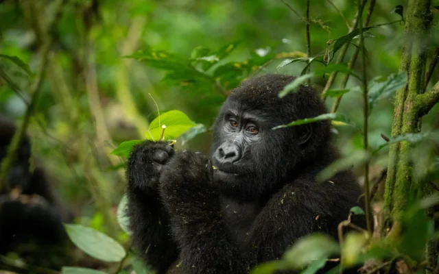
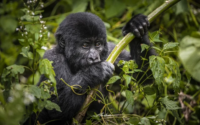
Wildlife, Birds, and Vegetation
Mount Kadam's natural interest lies in habitat transition. Sources describe lower dry landscapes, montane forest, forest-savannah mosaics, semi-evergreen thicket, and highland vegetation. Wildlife sightings are opportunistic, but birding, plants, butterflies, small mammals, and tracks can enrich the hike. Nearby Pian Upe offers the stronger conventional wildlife component.
Because the mountain is used by local communities, visitors should understand it as both ecological habitat and lived landscape. Responsible trekking avoids litter, unnecessary trail widening, and disrespectful behavior near homes, gardens, water sources, and sacred sites.