Mount Kadam is one of Karamoja’s most rewarding remote mountain adventures, rising to about 3,063 meters from the southern Karamoja plains near Nakapiripirit. It is a volcanic mountain of steep slopes, wooded sections, rocky summit approaches, highland communities, and wide views that connect the landscapes of Karamoja, Pian Upe, Mount Elgon, and eastern Uganda.
Compared with Mount Moroto, Mount Kadam hiking feels more expeditionary. Trailheads are less convenient, infrastructure is lighter, and routes often involve camping or long, demanding walking days. For fit travelers who want a serious off-the-beaten-path trek with cultural encounters and powerful scenery, Mount Kadam is one of Uganda’s strongest lesser-known mountain destinations.
This destination combines naturally with Pian Upe Wildlife Reserve, Mount Napak, Mount Moroto, and Sipi Falls in a well-planned Uganda safari route.
Quick Facts About Mount Kadam
| Feature | Details |
|---|---|
| Location | Southern Karamoja, northeastern Uganda, near Nakapiripirit |
| Elevation | About 3,063 meters above sea level |
| Mountain Type | Ancient volcanic mountain / prominent volcanic massif |
| Gateway | Nakapiripirit area, with links to Moroto, Pian Upe, Sipi Falls, and Mount Elgon |
| Communities | Kadam, Tepeth, Karamojong Pian, Pokot, Sebei, Iteso, and neighboring groups in the wider mountain landscape |
| Typical Duration | Often planned as a two-day trek, with longer routes possible through local operators |
| Difficulty | Challenging; steep, bushy, remote, and best for fit hikers |
| Best For | Remote trekking, highland camping, cultural travel, photography, and Karamoja adventure circuits |
Overview of Mount Kadam
Mount Kadam sits north of Mount Elgon and forms part of the volcanic highland chain that gives eastern and northeastern Uganda its dramatic edge. It is often described as Karamoja’s second-highest mountain and is notable for its prominence, remote feel, and cultural complexity. Its slopes rise from dry plains into forest, thicket, rocky ridges, and cooler highland zones.
The mountain is not a mass-tourism hiking route. It should be treated as a guided expedition with local coordination, porter planning if needed, and flexibility around weather, trail conditions, and community access. That rawness is central to its appeal. A Mount Kadam trek can feel like a genuine journey through a living mountain landscape, not a packaged summit walk.

Why Visit Mount Kadam?
One of Uganda’s Best Lesser-Known Treks
Mount Kadam delivers serious hiking without the crowds associated with better-known East African mountains. Routes can include steep climbs, forest sections, rocky approaches, campsites, and sunrise views across the Karamoja plains.
Rich Cultural Geography
The mountain is surrounded by several communities, including the Pian Karamojong, Pokot, Sebei, Iteso, Tepeth, and Kadama. A good guide helps visitors understand how these identities relate to the mountain without simplifying the region into a single story.
Strong Route Position
Mount Kadam works beautifully between Sipi Falls or Mount Elgon and the Karamoja interior. It can be paired with Pian Upe Wildlife Reserve, Mount Napak, Mount Moroto, and eventually Kidepo.
Top Things to Do on Mount Kadam
Complete a Guided Summit Trek
The summit route is the main draw. Hikers should expect a demanding climb, changing vegetation, rocky sections, and long walking hours. Some itineraries use a base camp before a summit push, while others adapt to group fitness and weather.
Camp in the Mountain
Camping gives Mount Kadam much of its magic. Sunset over the plains, cool mountain air, clear night skies, and sunrise from high slopes all make the trek feel more immersive than a rushed day climb.
Learn From Local Guides
Local guides interpret plants, water sources, settlements, clan territories, route history, and cultural etiquette. Their role is essential for both safety and responsible travel.
Combine With Pian Upe
Pian Upe Wildlife Reserve adds savannah wildlife, birding, and rock art possibilities close to the mountain route. This combination gives travelers a strong southern Karamoja circuit.
Photograph the Southern Karamoja Highlands
Mount Kadam offers wide plains, rocky ridges, settlement patterns, and changing vegetation. Light is best early and late, and summit days should allow time for landscape photography.
Learn more about things to do in Mount Kadam
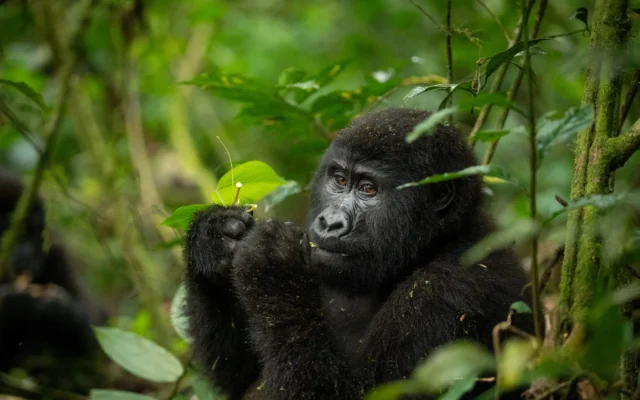
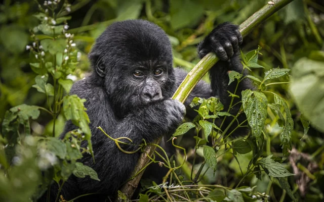
Wildlife, Birds, and Vegetation
Mount Kadam’s natural interest lies in habitat transition. Sources describe lower dry landscapes, montane forest, forest-savannah mosaics, semi-evergreen thicket, and highland vegetation. Wildlife sightings are opportunistic, but birding, plants, butterflies, small mammals, and tracks can enrich the hike. Nearby Pian Upe offers the stronger conventional wildlife component.
Because the mountain is used by local communities, visitors should understand it as both ecological habitat and lived landscape. Responsible trekking avoids litter, unnecessary trail widening, and disrespectful behavior near homes, gardens, water sources, and sacred sites.
Trekking, Safari, and Culture Route Planning
A practical Mount Kadam itinerary often starts from Sipi Falls, Mbale, Soroti, Moroto, or Pian Upe. Many travelers should allow two days for the mountain itself, plus travel time. Strong hikers may add Mount Napak or Mount Moroto, but the best routes include rest and recovery rather than turning Karamoja into a forced march.
For cultural travel, ask operators how community payments work, whether local guides and porters are used, and how photography consent is handled. The mountain is not just scenery; it is home.
Best Time to Hike Mount Kadam
Dry months usually provide better road access, easier camping, and safer footing on rocky sections. Rain can make the mountain greener but also slippery and slower. Heat on lower slopes can be intense, so early starts and water planning are important in every season.
{{SEC_GETTING_THERE}}
Getting to Mount Kadam
Mount Kadam is commonly approached through Nakapiripirit and southern Karamoja routes. Travelers may connect from Sipi Falls, Mount Elgon, Pian Upe, Moroto, or Soroti. Road quality and trailhead access vary, so a high-clearance vehicle and confirmed local guide arrangements are recommended.
Safety and Responsible Trekking
Do not attempt Mount Kadam without knowledgeable local guides. Carry adequate water, sun protection, rain layers, first aid, headlamp, and suitable footwear. Confirm food, camping gear, porter options, and emergency plans before the trek. Respect community land and follow guide advice around photography and village protocol.
Pian Upe Wildlife Reserve
The most natural safari pairing for Mount Kadam, adding savannah wildlife, Napedet Cave rock art, and southern Karamoja landscapes.
Mount Napak
Another steep Karamoja volcanic hike, useful for travelers building a multi-mountain trekking circuit.
Mount Moroto
A more accessible Karamoja mountain based from Moroto town, with Tepeth cultural context and flexible hike lengths.
Sipi Falls
A scenic eastern Uganda extension with waterfalls, coffee tours, hiking, and access toward Mount Elgon.
Mount Elgon National Park
A larger established mountain park south of Kadam, useful for travelers comparing Uganda's formal and remote trekking routes.
Sample Itinerary Ideas
A focused Mount Kadam trip can spend one night near Nakapiripirit, two days on the mountain, and continue to Pian Upe or Sipi Falls. A longer Karamoja route can add Mount Napak and Mount Moroto before ending with Kidepo Valley National Park. Adventure travelers with more time can build a full eastern Uganda mountain circuit from Jinja to Sipi, Kadam, Napak, Moroto, and Kidepo.
Mount Kadam is demanding, but for the right traveler it delivers exactly what remote mountain travel should: effort, silence, altitude, cultural depth, and a powerful sense of place.
Exploring Mount Kadam and Pian Upe Country
Mount Kadam rises above the semi-arid landscapes of northeastern Uganda and is closely linked with Pian Upe Wildlife Reserve routes. Guided hikes, community visits, and scenic drives can combine mountain viewpoints with dry-country birding and open plains.
Plan with a local operator familiar with Karamoja access, seasonal roads, and community protocols.
Custom Safari Planning for Mount Kadam
When you add Mount Kadam to a Uganda itinerary, treat it as a purposeful route decision rather than an afterthought. The best visits combine realistic drive times, local guiding, and nearby destinations that share geography or travel theme.
Start with how many nights you can spend in the area, whether you need an arrival or departure buffer, and whether the stop is mainly for wildlife, culture, scenery, adventure, or logistics. That framing helps you choose the right base, guide, and activity timing.
Strong Nearby Pairings
Many itineraries combine Mount Kadam with Pian Upe Wildlife Reserve. The most natural safari pairing for Mount Kadam, adding savannah wildlife, Napedet Cave rock art, and southern Karamoja landscapes.
Many itineraries combine Mount Kadam with Mount Napak. Another steep Karamoja volcanic hike, useful for travelers building a multi-mountain trekking circuit.
Many itineraries combine Mount Kadam with Mount Moroto. A more accessible Karamoja mountain based from Moroto town, with Tepeth cultural context and flexible hike lengths.
Many itineraries combine Mount Kadam with Sipi Falls. A scenic eastern Uganda extension with waterfalls, coffee tours, hiking, and access toward Mount Elgon.
Timing, Guides and Expectations
Morning starts often work best for cooler weather, smoother traffic, and better light. Confirm opening hours, boat or ferry schedules, permit rules, and guide availability before travel because local operations can change seasonally.
Use respectful travel habits throughout: ask before photographing people, follow site or park rules, support community-led experiences where possible, and keep expectations accurate for the destination type. This approach makes Mount Kadam feel like a meaningful part of your Uganda story rather than a rushed checkbox stop.
If you want help building a route that includes Mount Kadam, our team can suggest whether it works best as a half-day visit, overnight base, or multi-day regional extension.
- How high is Mount Kadam?
-
Mount Kadam is commonly listed at about 3,063 meters above sea level.
- Where is Mount Kadam?
-
Mount Kadam is in southern Karamoja, northeastern Uganda, near Nakapiripirit and north of Mount Elgon.
- Is Mount Kadam difficult?
-
Yes. Mount Kadam is a challenging remote hike with steep slopes, bushy sections, rocky approaches, and limited infrastructure.
- How long does Mount Kadam take to hike?
-
Many itineraries plan Mount Kadam as a two-day trek, though route length can vary by operator, fitness, weather, and trailhead access.
- Do I need a guide for Mount Kadam?
-
Yes. Local guides are essential for navigation, safety, community permissions, camping logistics, and cultural interpretation.
- Can Mount Kadam be combined with Pian Upe?
-
Yes. Mount Kadam combines naturally with Pian Upe Wildlife Reserve, Sipi Falls, Mount Napak, Mount Moroto, and broader Karamoja routes.